Countries
Bosnia and Herzegovina
No. Stages
14 stages
Length & Elevation
741 km, 14.760 m
Paved
71%
Unpaved:
29%
Trans Dinarica in Bosnia and Herzegovina
Anyone who has spent time in the heart-shaped Bosnia and Herzegovina instantly recognizes it is one of the rare places on the planet that unabashedly remains true to itself and its special blend of culture, food, music, and mountainous landscape. The Trans Dinarica bike trail does its best to bring this country’s unique character to adventurous cyclists.
Because Bosnia and Herzegovina forms the connection point for the larger loop that connects all eight countries and is the pivot point for the six inner Western Balkan countries (Bosnia and Herzegovina, Montenegro, Albania, Kosovo, North Macedonia, and Serbia), the country can be thought of as having two Trans Dinarica arms. One arm crosses Bosnia and Herzegovina’s western border from Croatia before heading south and eventually looping back to cycle for the northern arm which crosses back into the country over the eastern border from Serbia.
It is likely that many cyclists have yet to experience the northern section of Bosnia and Herzegovina’s Trans Dinarica. This is wonderful news — it means there is an entire world ready to be discovered. However, there is likely a reason for this. The northern arm is significantly less touristy and a great choice for authentic bicycle adventures. Again, great news … you may be among the first of your friends to experience many of the cultural aspects of the area that stretches from the Serbian border, through Drina National Park, to the capital of Sarajevo, around Prokoško Lake, and to the city of Livno near the Croatian border. On the southern part of the route through Bosnia and Herzegovina, which connects Croatia and Montenegro, you will pass the Blidinje Nature Park, the world-famous Mostar with its beautiful stone bridge over the Neretva River, and wild mountains south of Sarajevo.
Highlights along the Trans Dinarica in Bosnia and Herzegovina:
- Cycle through the wild and beautiful Drina National Park.
- Walk through the Baščaršija in Sarajevo.
- Visit Prokoško Lake, hidden in the mountains.
- Admire the islands in Rama Lake.
- Relax with wild horses in Livno.
Map of Trans Dinarica in Bosnia and Herzegovina
Video about Trans Dinarica in Bosnia and Herzegovina
Trans Dinarica Bosnia and Herzegovina Gallery


Ready to get navigation/information pack?
Navigation PackMain Route of Trans Dinarica in Bosnia and Herzegovina
Stage 1: Livno - Tomislavgrad
 Distance:
39 km
Distance:
39 km Elevation:
520 m
Elevation:
520 m Paved:
100%
Paved:
100% Unpaved:
0%
Unpaved:
0%The Trans Dinarica cycle route in Bosnia and Herzegovina continues north and east from the city of Livno. Livno, near the western edge of Bosnia and Herzegovina and the border with Croatia, is an important destination for several reasons. Livno sits at the confluences of several rivers and streams (make sure you go see the Duman spring under the mighty walls at the edge of the city). It is a tourism center and is famous for the wild horses that roam the surrounding area. The city is also world-famous for its tasty cheese, ‘Livanjski sir’, which dates back centuries. For the Trans Dinarica, Livno is also important because it represents the point where the interior part of the Balkan cycle route (the part that connects the Western Balkans of Bosnia and Herzegovina, Montenegro, Albania, Kosovo, North Macedonia, and Serbia) meets to form a loop, that can be viewed as an independent trail/itinerary.
The bike stage itself is an easygoing ride … rolling with well-spaced ascents and descents that provide just the right cycling challenge. After the stage heads south, it turns east — about halfway across the stage — towards the final destination of Tomislavgrad. Along the way, you’ll ride past Mandek Lake, where you’ll find Mišići Plaža, or Muscle Beach.
The town of Tomislavgrad, where Croatian King Tomislav was crowned in the 925, is surrounded by beautiful nature, open fields, the mountains and foothills of the Dinarica Alps, and UNESCO-inscribed stećci: car-sized, often-carved, medieval tombstone blocks. In the town itself, visit the Franciscan Duvno Basilica, Monastery, and Museum. If you have time on the way, stop at the regional highlight of Buško Blato (Buško Lake), which is located around 15 kilometers west of Tomislavgrad. On the southern banks of the lake, the Karmel sv. Ilije (Carmel of St.Elijah) Monastery is recommended and also has places to sleep.
It is important to note, however, that the approximately 10-kilometer section of the main road from Buško Lake towards Tomislavgrad is quite busy during certain months (summer) and hours, which can be unpleasant when driving slowly uphill. We recommend that you head out on this section in the early morning hours.


Stage 2: Tomislavgrad - Mostar
Distance:
78 kmElevation:
920 mPaved:
73%Unpaved:
27%This is a memorable bike tour stage in Bosnia and Herzegovina’s section of the Trans Dinarica. The route starts from Tomislavgrad and gently rolls over hills and along asphalt roads. Along the way, you’ll pass through the villages of Srđani, Rašćani, Mandino Selo, Lipa, Bogodol, and Goranci on the way to the famous, UNESCO city of Mostar.
An early highlight on this bike path is Blidinje Lake, at about the 25-kilometer point of the stage. This natural mountain lake, the largest in Bosnia and Herzegovina, is a beautiful body of water surrounded by mountains and just a scattering of houses around the lake, which sits at a height of nearly 1,200 meters. The good asphalt roads until here are perfect for cycling. For about 15 kilometers, starting at the 33-kilometer point, the stage shifts from asphalt to scenic gravel road. As you descend towards the valley, riding surface becomes softer and has larger stones, which makes riding a loaded bike quite challenging. This section will be especially demanding if you tackle it in the opposite direction – from Mostar towards Tomislavgrad (expect some hike & bike fun).
We got all sorts of opinions from cyclists for this stage: from it being terrible to it being her (and she was riding a gravel bike, not a MTB!) best stage on the entire Trans Dinarica. Let’s add that from Tomislavgrad all the way to Mostar there are not many restaurants (there’s one close to Blidinje lake) or shops, so this is a stage for which you need to be well prepared physically, mentally and with food and drink supplies. Good luck, have fun!
Only the last couple of kilometres the cycling is all asphalt as you pedal below ridgelines into the Neretva Valley. But the real reason for the once-in-a-lifetime claim is because you’ll be pedaling to one of the most memorable architectural views in the Balkans: the UNESCO-inscribed Mostar Bridge connecting the banks of the Neretva River.
The city of Mostar, squarely in the Herzegovina Region of Bosnia and Herzegovina, is a beautiful and historic hub for culture and cycling adventure seekers. This is the place to seek bike repairs, gather any supplies, and also give yourself a bit of time for sightseeing. There are museums and a wonderful tangle of streets filled with souvenir vendors and cafes. But the chief site is its famous bridge. The Ottoman-era bridge, destroyed during the conflict of the 1990s, was rebuilt in 2004 and is again the central attraction in town. Be sure to watch as the bridge divers take turns with leaping from the 20-meter-high stone, architectural wonder.
Two more good ideas if you want to take a break from cycling in Mostar: the city offers daily bus trips to Sarajevo (in case you don’t go there by bike), the trip lasts from 6 AM to 6 PM. Second: there are quite a few climbing via ferratas around the city, if you need a guide, contact Julijana in time.
From here, riders can also check out the Ćiro Trail. A former train route, built during the Austrian era from Mostar to Dubrovnik, Croatia, has been converted into a bike path.
Important note for anyone continuing on the main Trans Dinarica route towards Montenegro: there are no ATMs from Mostar until Žabljak. So you will need some Bosnian Marks and Euros (for Montenegro) for the next six stages. Most accommodations and restaurants only take cash.


Stage 3: Mostar - Boračko Lake
Distance:
54 kmElevation:
1.420 mPaved:
69%Unpaved:
31%This Bosnia bike tour stage — the fourth since cycling into Bosnia and Herzegovina — turns north into the middle of the country as the Trans Dinarica winds its way up towards Sarajevo and the Mount Bjelašnica massif. The reason for the turn north is based on the need to stay true to the fundamental philosophy of the Trans Dinarica: find logical, yet beautiful routes that allow riders to enjoy the stage and avoid traffic whenever possible.
This day will start by heading north along the Neretva River. At the village Potoci, about 10 kilometers into the ride, the route heads northeast. The day will have roughly equal parts of asphalt climbing as gravel descents. Along the way, there is a little of everything. There are multiple points with incredibly photogenic panoramas, including the hilltop at Rujište (approximately 25 kilometers into the stage), which sits at the bottom of Prenj Mountain and has a small ski resort. There are big sweeping descents when you can relax your legs and let the wind blow back your hair. There are stećci: UNESCO-inscribed, medieval tombstones-adding cultural depth to your Bosnia cycling adventure. After the second climb near Gornji Zimlje (at around 30 kilometers), the trail starts to make its descent.
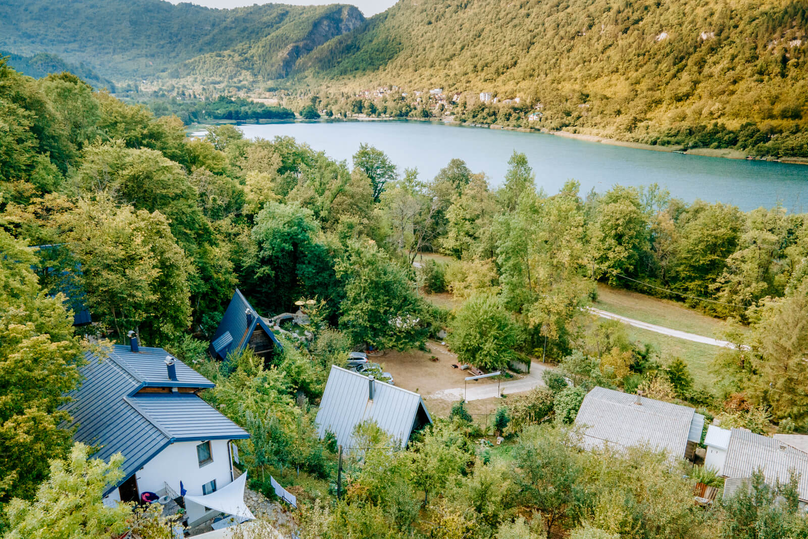
The day ends at Boračko Lake, about 20 kilometers south of the city of Konjic. A glacial lake with views of Prenj Mountain, Boračko is stunning … and quite popular in the summer months, providing relief when the weather gets hot. Cyclists should consider booking accommodations early; in summer due to full occupancy, in the off-season due to closed accommodations.


Suggested accomodation:
Herzegovina Lodges
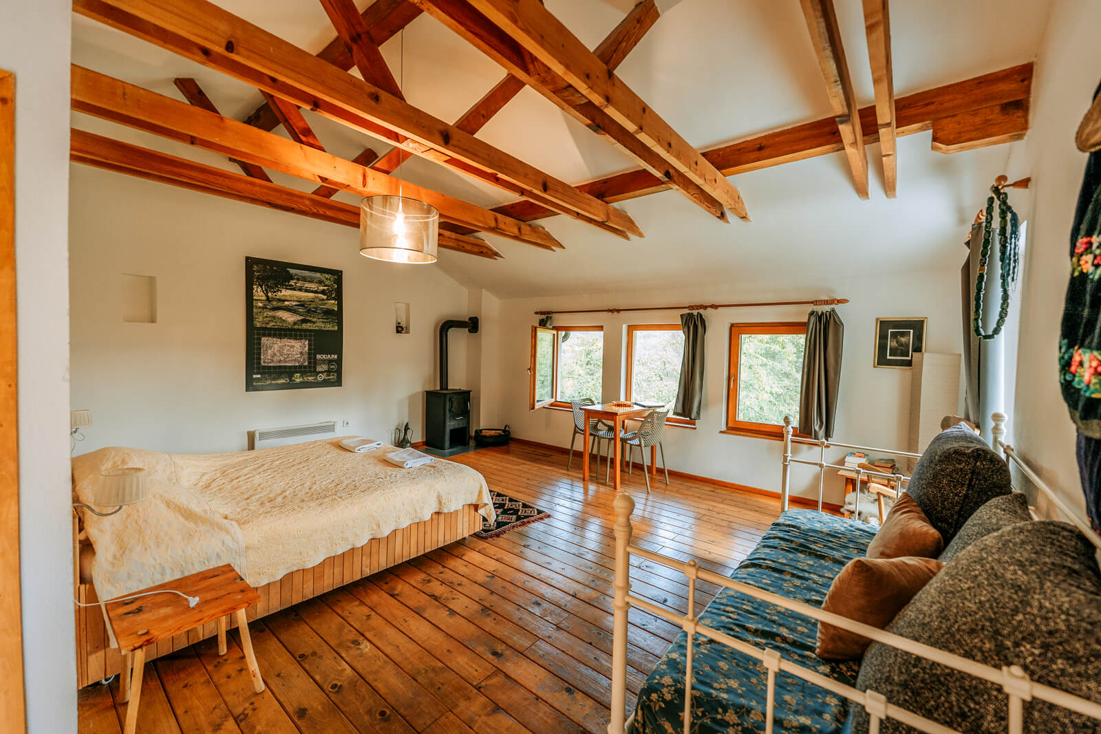
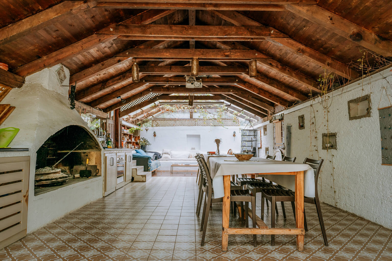
On the southern side of Boračko lake, just below the steep forests, you will find a place where you will want to stay longer than one night. Especially when you hear Herzegovina Lodges owners Goga and Elmir talk about history, nature, hidden magic places of the area and about the production and cooking of traditional food (if you order in advance, you can also taste it). If you take the time, you will understand why Herzegovina Lodges are synonymous for hospitality, sustainability, eco-tourism, art, culture, building bridges … for peace. They have rooms and apartments for two to six people, and in addition – how convenient – a bicycle garage with the possibility of charging e-bikes and the laundry service for your sweaty clothes (the stage from Mostar to Lake Boračko is not an easy one!). More info: website / facebook / instagram
Stage 4: Boračko Lake - Tušila
Distance:
44 kmElevation:
1.590 mPaved:
100%Unpaved:
0%Ranking up there with one of the most interesting and diverse bike rides of the entire Bosnia and Herzegovina section of the Trans Dinarica, this stage from Boračko Lake to Tušila will provide enough inspiration to come back to the region over and over to find new trails.
This day’s cycling route starts at Boračko Lake and then winds its way along the Neretva River for around half the day’s ride. 10 kilometers from the lake there is a small shop on the right, take advantage of it, because the wilderness awaits you. At approximately the 16-kilometer point, the route starts a steady climb around the southeastern edge of Mount Visočica. Along the way, the ride has a series of beautiful, challenging ascents and wonderful, sweeping descents. You’ll pedal past more stećci (UNESCO-inscribed, medieval tombstones), plenty of forgotten villages, and have lots of photo-worthy panoramas to reflect on the ride.
The day ends in the village of Tušila, where there are several options to stay overnight. However, one of the interesting aspects of the stage is that there are extension possibilities. Just over the Rakitnica Canyon, which separates Mount Visočica from the Bjelašnica Massif, you have a couple of iconic settlements: Umoljani and Lukomir, Bosnia and Herzegovina’s highest village. There are several accommodation possibilities through this section so you can take your time and stop when you find the right place along your route.


Stage 5: Tušila - Kalinovik
Distance:
35 kmElevation:
810 mPaved:
6%Unpaved:
94%This fairly short (but still not easy) mostly gravel biking stage gives you a chance to catch your breath after yesterday’s big ride. The route makes a short climb from Tušila and follows the Tušilska Rijeka (river) for the first 3.5 kilometers. After, the trail descends slowly and then with serpentine turns for the next eight kilometers (until about the 12.5-kilometer point) along the beautiful Ljuta River until you reach the village of Ljuta.
At the village of Ljuta, the climb begins. For around 15 kilometers, you’ll pedal uphil on a gravel forest road until you begin the easy eight-kilometer descent into the day’s stage ending: Kalinovik. In Kalinovik, which rests on the slopes of Mount Treskavica, there’s a small shop and the only major accommodation in the area, Hotel Moskva (Moskva means Moscow). There is also a mountain campsite open nearby in the season, look for it in the list of POIs.


Stage 6: Kalinovik - Šćepan Polje (Montenegro)
Distance:
60 kmElevation:
950 mPaved:
63%Unpaved:
37%The last stage of Trans Dinarica’s Bosnia and Herzegovina bike route (or the first, depending on your direction) continues east and then south toward the Montenegro border. The day will end at Šćepan Polje, near the junction where the Piva and Tara Rivers combine to become the Drina.
Leaving Kalinovik, this stage follows a state road (the R434a). After a steady 10-kilometer climb, the route tilts sharply down into a long 10-kilometer descent. This scenic downhill stretch, which follows a ridge, will take cyclists down through forests to the Krupica River and valley below and as you approach the intersection with the larger M18 highway.
After crossing the M18, cyclists will again pass onto small village roads. Continue your rolling (but mostly descending) ride, with the Bistrica River to the south. After a dramatic climb that lasts for approximately 10 kilometers (between kilometers 20 and 30) and you pedal through the villages of Budanj and Štović, you will cycle along the Bistrica River until meeting up with the Drina River in the town of Brod around three kilometers south of the city of Foča. In Brod, or even better in Foča, only three kilometers away, you can stock up on supplies for your journey – don’t expect many shops until you get to Žabljak in Montenegro! This area can also be a good choice for finding accommodation if the stage to Kalinovik was too short for you or perhaps the range of hotels there wasn’t to your taste.
The last 20 kilometers as you approach the finish can become increasingly unpleasant during the season, as on this single, narrow road, local van drivers compete to transport the most guests to the rafting starting points. If possible, choose an early hour for this section.
The day ends as you follow the Drina River to the border between Bosnia and Herzegovina and Montenegro. You will see many camps and rafting centers with accommodations along the river. You will also feel the energy of travelers gathered around the famous rivers — Drina, Tara, and Piva — awaiting their chance to take a plunge. On weekends, these idyllic spots above the river can be the scene of loud parties. If you suspect this may happen, choose a cabin or tent site as far away from the restaurant with a fireplace as possible. Of course, you can also join them and celebrate the end of cycling through Bosnia and Herzegovina.


Stage 7: Bajina Bašta (Serbia) - Klotjevac
Distance:
24 kmElevation:
360 mPaved:
57%Unpaved:
43%Short explanation: Bajina Bašta – Klotjevac is actually the first stage in Bosnia and Herzegovina if you come to this country from Serbia on the Trans Dinarica cycling route. The last Serbian stage ends in Bajina Bašta, a pleasant town by the beautiful river Drina. Since you have two stages ahead of you through more remote places in the east of Bosnia and Herzegovina, we recommend that you stock up on food and drinks here.
Soon after you’ll cycle past one of the most unusual houses in the world, the House on the Drina, on your right, you will cross the national border. You will continue along the left bank of the Drina River, which will become a large accumulation lake beyond the Perućac dam. The end of the stage is in the village of Klotjevac, which has very limited accommodation options, so we recommend early booking – or some ingenuity when communicating with the locals.
For your consideration: if you want to avoid the demanding macadam climb from Klotjevac (read the description of the next stage), you can choose the state road R452 (not too busy) after leaving Bajina Bašta and join the existing second stage after about 40 kilometers, near the village of Pusmulići. But keep in mind that there is not much accommodation in the area, so some ingenuity or adjusting the length of the daily stages will be required.
Otherwise, this stage is relatively short and flat, but with good reason – tomorrow you will be tackling one of the more challenging stages on the entire Trans Dinarica with almost 2,000 meters in altitude. Let the peaceful lake be a place of rest and relaxation before your big bicycle adventure.


Stage 8: Klotjevac - Han Pijesak
Distance:
63 kmElevation:
1.940 mPaved:
64%Unpaved:
36%Welcome to the wilderness, welcome to adventuring travel in Bosnia and Herzegovina. After you left Serbia yesterday, today’s stage with almost 2.000 of elevation will be among the Trans Dinarica Cycle Route’s most challenging. For those who seek remote stretches on rides, this is a day to circle on the calendar and route map. The climbs along this stage are regular and at times steep. However, the reward is an entire day of discovering virgin territory and jaw-dropping views.
Soon after the bike route leavs Klotjevac, expect a steep gravel climb, where those with fully loaded bikes will likely dismount and push uphill. Once you reach Ljeskovik, a some 5 kilometres after the start of the stage, cycling will become easier. The route then heads west, past the turnoff for the town of Srebrenica and into the interior of Bosnia and Herzegovina. From there, cyclists will head into the deeply forested Dinaric Alps — the cycle route’s namesake — where incredible nature awaits on easy-to-follow gravel roads and paths.
Again, it should be noted that cycling through the Drina National Park is, philosophically, at the core of what this cycle route represents: giving cyclists the chance to see the entire region — beyond just the well-known places. The route’s purpose is to unite the whole Western Balkans and its most beautiful places.
The stage ends in the town of Han Pijesak, which is cradled among the hills and sits at 1.080 meters. There aren’t many accommodation options in the town, but we can recommend the Planinska kuća on the northern outskirts of the town, which offers good meat, fish specialties and soups (you should try ‘pasulj’, thick beans soup).


Alternative suggestion:
Klotjevac – Klotjevac Fortress
- Distance: 4 km
- Elevation: 320 m
- Paved: 12 %, unpaved: 88%
A possible alternative for the first part of this stage passes by the remnants of Klotjevac fortress. That is a bit steeper ascent with no asphalt at all, but the gravel is better than the one on the main route. Before the ascent, there is a campsite on the shore of the lake.
Stage 9: Han Pijesak - Sokolac
Distance:
27 kmElevation:
250 mPaved:
85%Unpaved:
15%A much-needed rest after a big cycling challenge and an easy and mostly downhill stage takes riders from Hans Pijesak to the town of Sokolac. Sokolac is located in the hills and in the shadow of Mount Romanija.
Traveling the Balkans to Bosnian south and west, cyclists will descend into beautiful and green countryside leading to Sarajevo, the capital of Bosnia and Herzegovina. This is a good day to relax with another philosophical purpose and reason for the Trans Dinarica’s development: to encourage travelers to move at human speed through peaceful and largely pristine fields and farms, villages, and settlements.
In Sokolac, you’ll find cafes, bakeries, and places to stay — even with spa to work out any soreness and fatigue. There is wonderful hiking here on and around the Glasinac Plateau. As well, take time to check out the Orlovača Cave, which is one of the area’s most attractive adventure activities. However, if you find the stage too short, you can pedal harder and earlier from Han Pjesak all the way to Sarajevo, the destination of the next stage.


Stage 10: Sokolac - Sarajevo
Distance:
57 kmElevation:
710 mPaved:
48%Unpaved:
52%The Trans Dinarica continues west for a beautiful stage — with several potential alternate route possibilities — to the capital of Bosnia and Herzegovina, Sarajevo. As with any cycle route that goes through a city with the importance and size of Sarajevo, there are many ways to cycle to the country’s largest urban area. The route travels across rolling hills with a fairly equal number of climbs and descents.
With the TD 3.0 navigation package update in autumn 2025, we have added a connection via the newly renovated cycle path along the abandoned railway line as the main option for this stage. This is a section that we had already covered two years ago, but due to collapsed bridges and poor condition, it was not safe. Now, arriving in Sarajevo through the Miljacka River Gorge is a real cycling romance, taking you through wild nature directly to the city center. The route has been completely renovated, with hard-pack gravel, there are guardrails on dangerous sections, and the tunnels are even equipped with sensor-controlled lighting. A wonderful experience! What we don’t recommend on Pale – Sarajevo section, is using the main road (M5), which is fast, busy and dangerous.
Once in Sarajevo, which sits in a valley along the Miljacka River, cyclists can enjoy one of the cultural capitals of Europe. Besides the shops and cafes of the Baščaršija district — showing the city’s history from the Ottoman era — some of the best restaurants in the region can be found here. One such restaurant is Žara iz Duvara (the Singing Nettle), which serves a fusion of traditional dishes and uses only natural ingredients.
Besides history — where the East meets the West with a combination of Ottoman, Austro-Hungarian, and modern architecture — there are world-class museums and galleries, not to mention fantastic hiking possibilities. Be sure to ride the cable car from the city center to Trebević for great views and the chance to see the route you’ve cycled.

-

- New section of the cycling route towards Sarajevo, Bosnia and Herzegovina.


Alternative suggestions:
Pale – Trebević – Sarajevo (passing bobsleigh track)
- Distance: 24 km
- Elevation: 550 m
- Paved: 100 %, Unpaved: 0 %
We admit, it will be difficult to decide: the main route along the abandoned Ćiro Trail railway line is tempting, but nowhere else in the world will you be able to cycle along the abandoned bobsleigh track from the 1984 Olympics. To reach it, you will have to choose a road from the town of Pale that takes you under Mount Trebević, and from there an adrenaline-pumping descent towards the city follows. At your own risk! We would add that the Olympic bobsleigh track might be worth taking an extra day in Sarajevo and going on a cycling-bob trip (without luggage).
Bobsleigh track
Don’t know how to ride a bobsled? Neither did we. Ride to your best ability and expect people taking selfies in the middle of the curve. Good luck!
- Distance: 3 km
- Elevation: 70 m
- Paved: 83 %, Unpaved: 17 %
Stage 11: Sarajevo - Kreševo
Distance:
56 kmElevation:
810 mPaved:
91%Unpaved:
9%From Sarajevo, the Trans Dinarica heads due west for around 40 kilometers. The route flattens out just a bit and the riding becomes more rolling with beautiful river valleys and hills at the foot of the Dinaric Alps. The day’s final destination is the town of Kreševo — but there is still a lot to discover in the surroundings around Sarajevo and its Olympic mountains before traveling into the western half of Bosnia and Herzegovina.
The bike trail takes cyclists from the center of Sarajevo to the town of Ilidža, which is really a suburb of the capital of Bosnia and Herzegovina. Famed for its sulfur spas, plane and chestnut trees, and incredible Austro-Hungarian architecture, it is also the gateway to Vrelo Bosne, the source of the Bosna River. Vrelo Bosne sits beneath Mount Igman, another Olympic mountain. The area — a swirl of lakes, islands, and swans — spreads out across more than six square kilometers. It is the perfect place to take a long break and relax with the rhythms of Bosnia and Herzegovina.
The route then heads to the town of Kreševo, which sits in almost the center of Bosnia and Herzegovina framed by mountains. At the confluence of the Kreševka and the Lepenica Rivers, Kreševo has been a vital area for mining since the Roman era and was important to the Bosnian Kingdom during the Middle Ages. Today, the town of Kreševo is a place to see traditional Bosnian architecture, visit the Franciscan Monastery, and take a break in the middle of some of the Western Balkans’ most beautiful mountains. Looking for a special place for overnight? Book your stay at Hobbiton (about seven kilometers north), where a family has constructed a Hobbit village, where you can sleep like a hobbit, tucked in the hills. Please note that outside visitors are not allowed.


Stage 12: Kreševo - Fojnica
Distance:
30 kmElevation:
510 mPaved:
100%Unpaved:
0%The Balkan travel route continues to the town of Fojnica. At the crossroads of several streams and rivers and in the Fojnička River Valley, which leads to and is a tributary of the Bosna River, Fojnica is one of the underrated destinations in Bosnia and Herzegovina. Surrounded by mountains, filled with cafes, restaurants, and hotels, Fojnica is a well-known center for springs that fuel health spas — both for medical purposes and for relaxation. Of course, don’t expect luxurious five-star hotels, but we cyclists are happy with a clean bed, a warm pool, and a cold beer. Stay in town to loosen up after a few days of cycling, but make sure to also visit Fojnica’s 14th-century Franciscan Monastery.
Next day, you’ll cycle from Fojnica to one of the region’s most popular sites: Prokoško Lake, which is not far from the main tomorrow’s route. Sitting at 1.636 meters, the majestic lake in the mountains is surrounded by traditional-looking wooden houses. Around the lake, there are some places to stay, restaurants, and cafes. Travelers should be aware that the lake can become quite crowded in the summer. Late spring and fall are the best times to cycle here.


Stage 13: Fojnica - Gornji Vakuf
Distance:
54 kmElevation:
1.230 mPaved:
42%Unpaved:
58%This stage of the Bosnia bike tour will take cyclists 53,5 kilometers west to the town of Gornji Vakuf, on the banks of the Vrbas River. From Fojnica, expect a long gravel climb, which may be used by jeeps and vans full of tourists during the tourist season, so set off early to avoid breathing dust. On the highest point, you will not be far from the Prokoško Lake, which is worth a visit (outside the high season, when it can be crowded). Only for wild extremist cyclists, a direct connection to Gornji Vakuf is also possible, but it crosses very bad macadam over high mountains, where you have nowhere to hide in case of bad weather. We recommend that from the lake you return to the classic route, which will take you down the gravel road, where you can expect mud in in case of rain and forestry.
Dating back to the 17th century, Gornji Vakuf has a traditional bazaar, or čaršija, and has plenty of places for cyclists to eat and lodgings to sleep. Ethno Village Mirna Dolina, about 12 kilometers from the center of Gornji Vakuf, is worth the visit. The expansive property has restaurants, accommodations, a playground, and sports areas … all set in the beautiful hills. If your legs are not too tired, you can pedal to Lake Rama (see the description of the next stage).


Stage 14: Gornji Vakuf - Tomislavgrad
Distance:
60 kmElevation:
1.360 mPaved:
81%Unpaved:
19%From Gornji Vakuf, the long distance bike trail heads south to Raduša Mountain and then down to the beautiful Ramsko Jezero (Rama Lake). The lake, an artificial reservoir, has islands and an infinite number of places to take great photographs. The climbing and descents can be challenging, but being challenged and then rewarded with discoveries is exactly why cyclists found the Trans Dinarica to begin with. The descent to the lake itself is magnificent with views the whole time of the landscape.
After Ramsko Jezero, the Trans Dinarica flattens out almost completely to the historic town of Tomislavgrad. The route is now nearing the westernmost edge of Bosnia and Herzegovina. Dating back to the Roman Empire, the town of Delminium (as it was then known) was an important center on routes between East and West. In Tomislavgrad, there are multiple places to eat, drink, sleep, and refuel and resupply for the days of cycling to come.


Alternative suggestion:
Pidriš – Ramsko Lake (Šćit “island”)
- Distance: 30 km
- Elevation: 440 m
- Paved: 100%, unpaved: 0%
While climbing to Raduša mountain, the views towards the Ramsko Lake open, showing the road line, as thin as a hair, which boldly and stubbornly crosses the water to Šćit “island” (with its Franciscan monastery and another viewpoint). Suggesting nice and paved alternative from Pidriš to Prozor and to the Šćit in the middle of the Ramsko Lake. According to the brochure Cycling through Rama, the whole area around the lake is a little Balkan cycling paradise.
Secondary routes of Trans Dinarica in Bosnia and Herzegovina
Stage 15: Sarajevo - Brda
Distance:
57 kmElevation:
1.420 mPaved:
49%Unpaved:
51%This scenic alternative stage on Bosnia and Herzegovina’s section of the Trans Dinarica Cycle Route accomplishes several important missions. First, it serves to connect Sarajevo, which sits on the northern stretch of Bosnia and Herzegovina’s part of the route — running between the Serbian border (at Tara National Park) to the Croatia border (west of Livno) — to the country’s southern stretch (from Livno to the Montenegrin border). Secondly, this path provides cyclists with multiple smaller “loop” options within the larger loop that encompasses the six southern countries along the route. Finally, this stage provides cyclists access to incredible scenery and pedaling as they come from the capital city, Sarajevo, over the Bjelašnica Pass — crossing the massif and bringing travelers to the incredible villages. However, to make this link from Sarajevo, you will have to climb quite a steep climb, partly on poor macadam (tourist rides with four-wheelers do not exactly help to maintain the gravel road). If you would like to avoid this, you can choose the main road via Bjelašnica, which is very busy up to the village of Krupac.
Starting about 17 kilometers into the ride, the road tilts up and ascends for much of the rest of the day. There are rolling sections between the 40 and 50-kilometer marks before descending into Brda and the stage’s end. Soon, you’ll need to decide if you want to join the stage towards Kalinovik (towards Montenegro), Boračko Jezero (towards Mostar) or choose a one-way day trip to Lukomir, the highest village in Bosnia and Herzegovina (see stage 16).


Stage 16: Brda - Tušila
Distance:
32 kmElevation:
620 mPaved:
34%Unpaved:
66%This alternative stage along Bosnia and Herzegovina’s stretch of the Trans Dinarica Cycle Route is one certainly worth taking. Not only does it take cyclists to a couple of the area’s most iconic settlements, but it gives you options to continue along the main route heading south toward Montenegro (via Kalinovik) or towards Croatia (via Mostar).
The stars along this rolling ride from Brda are the villages of Umoljani and Lukomir, which is Bosnia and Herzegovina’s highest village. Of special note: If possible, take extra time in Lukomir to take photos, of course, but also to learn how herders have lived for centuries in the Bosnian mountains. There are a couple of accommodation possibilities through this section so you can take your time and stop when you find your place along the route.
This rewarding “alternative” stage ends in the tiny but beautiful village of Tušila, which sits on the Tušilska Rijeka (stream). From here you will be back on the main route.


Do you support sustainable travel?
Support SustainabilityUseful information about logistics in Bosnia and Herzegovina
- Capital: Sarajevo
- Language: Bosnian, Croatian and Serbian
- Currency: The convertible mark
- Driving side: right
- Calling code: +387
- Emergency numbers: Ambulance 124, Fire brigade 123, Police 122
- The biggest towns close to Trans Dinarica: Sarajevo, Mostar, Dubrovnika and Split (Croatia)
- Airports: Sarajevo, Mostar, Tuzla, Banja Luka, Dubrovnik (Croatia), Split (Croatia)
- Trains: Railways of Federation of Bosnia and Herzegovina, Railways of Republika Srpska
- Buses: Flixbus, GetByBus, BusTicketMe
- Local tourist organizations: Federation of Bosnia and Herzegovina, Republika Srpska, Sarajevo, Mostar, Gornji Vakuf – Uskoplje, Tomislavgrad, Livno, Foča
The largest cities (transportation hubs and tourist centers) on Trans Dinarica in Bosnia and Herzegovina (BiH) are Sarajevo and Mostar. Apart from those cities, there no other centers of that size even near the route, but some smaller and still significant towns are: Livno, Tomislavgrad, Prozor, Gornji vakuf – Uskoplje, Fojnica, Sokolac, Foča, and (in Serbia) Bajina Bašta. Croatian Adriatic city Split is close to Sinj on TD, and can also be a great entering point.
As in other TD countries, the two possible routes in BiH lead you through beautiful but somewhat remote areas. Thus, the possibilities to take transport to the route are limited. Best bet is of course Sarajevo that can be reach by plane or bus (or train from south). But it is also wort mentioning that Mostar is just 157 km far from Dubrovnik – and you can actually cover that part riding along a former narrow gauge railway which has been reconstructed and signposted as a bike route, “Ćiro trail”. This turns the approach to TD from the Adriatic coast into an unforgettable journey in itself.
Trains
There are only 1.000 km of railway routes in BiH – here is the map of the network. There are no international connections as the network is disconnected from the European train network. There are two train operators: the Railways of Federation of Bosnia and Herzegovina and the Railways of Republika Srpska (the main line there is Doboj – Banjaluka – Sarajevo, which probably will not cover any needs of TD travellers). In the full season (end of May to end of August) there is a very convenient line from Croatian port Ploče to Sarajevo (passing Mostar as well), but only on Fridays, Saturdays and Sundays (full info is here, but only in Bosnian language). There is only one departure per day (in the late afternoon), and the price is very reasonable – 13 EUR to Sarajevo (20 EUR for return ticket). The same line to Sarajevo operates throughout the year and has three departures a day – just not from Ploče but from Čapljina, a small town on the Bosnian side of the border, 37 km away from Ploče.
NOTE: the trains do not have designated space for bicycles (the coaches are old-fashioned, with steps at the entrances), and operators don’t have official rules for passengers with bicycles. You will most likely have to buy a bike ticket from the conductor (if there’s space); you cannot buy (reserve) it in advance. And certainly don’t count on trains it if you travel as a group.
One interesting insider tip from the field: in Mostar the train may be fuller and they don’t want to accept bikes (there’s maybe room for 5-6 bikes on one train). Apparently, there’s a better chance that you’ll be able to get a bike space in Čapljina – and you can cycle there on the nice, easy Ćiro trail.
One more interesting approach to TD in Bosnia: by train from Belgrade to Zvornik (two departures per day, designated place for bicycles) and then ride to Han Pijesak (70 km).
Busses
This type of transportation in Bosnia will give you both more possibilities and more chances to succeed. You can check connections by international companies such as Flixbus, but if they won’t accept bicycles just check local stations and companies via GetByBus or BusTicketMe. It can also be useful to visit web pages of Sarajevo and Mostar bus stations. Buses are reliable, and for most places there several departures per day. Operators also don’t have official policies about bicycle transport, but conductors will usually accept 1-2 bicycles if a bus is not very crowded. Bus prices are affordable and the same applies to bicycle surcharges.
Van /taxi / transport provided by camps
This could be a viable or even best option if you travel in a group. For shorter distances (up to, let’s say 30 km), the taxi price split between 2-4 people can prove to be quite “healthy” for your travel budget. If you stay in a camping, they will very often they will kindly accept to pick you up, and especially if it is a rafting or hiking camp, they might even do it for free.
There are regular van lines between many mayor cities or towns in the region. Just to give you an orientation: for a van line from Belgrade to Mostar with one departure each day, the price is 45 EUR – and they will pick you up at a place of your demand, and leave you on the destination at the point that you want. The only problem with regular vans is that they won’t have much space for bicycles – but one person should be always accepted. (They will be able to tell you this in advance.) Same service can be found for other places in Bosnia.
And finally, a private van ride in Bosnia will definitely be great and economical option, sometimes for even as low as three people, not to mention more than that. Search it online where you are, or at the destination you plan to reach soon. Here’s a contact of Emir, who drives a 9-seats van in Sarajevo: +387 61 071 841.
Ready to get navigation/information pack?
Navigation PackYou might also like ...


Feeling overwhelmed with travel planning?
Leave this time-consuming and stressful task to professional tour operator companies that we suggest and just enjoy the tour.
Ask a professional


