Countries
Slovenia
No. Stages
4 stages
Length & Elevation
264 km / 4.570 m
Paved
79%
Unpaved:
21%
Trans Dinarica in Slovenia
Cycling in Slovenia offers an incredible mix of alpine landscapes and Adriatic coastlines, making it a dream destination for cyclists. Slovenia is widely known as one of the most sustainable travel destinations on the planet. In every region of this small but culturally rich and mountainous country, cities, towns, and villages are inventing ways to both share their heritage with adventurous travelers and share their desire to keep the nation’s natural beauty intact so that future generations can enjoy this special corner of Europe. Make no mistake, the care and respect for the environment you feel when you are in Slovenia is genuine.
Not surprisingly, Slovenia’s cycling routes are one of the best anywhere. In the last handful of years, incredible Slovene professional cyclists and a growing number of amateur cyclists have worked in conjunction with (and inspired) a growing amount of countrywide bicycle infrastructure. Not surprisingly, there are wonderful routes across the country, The Slovenia Green Routes, for instance, combine culture, food, relaxation, off-the-beaten-path locales, and top-notch pedaling.
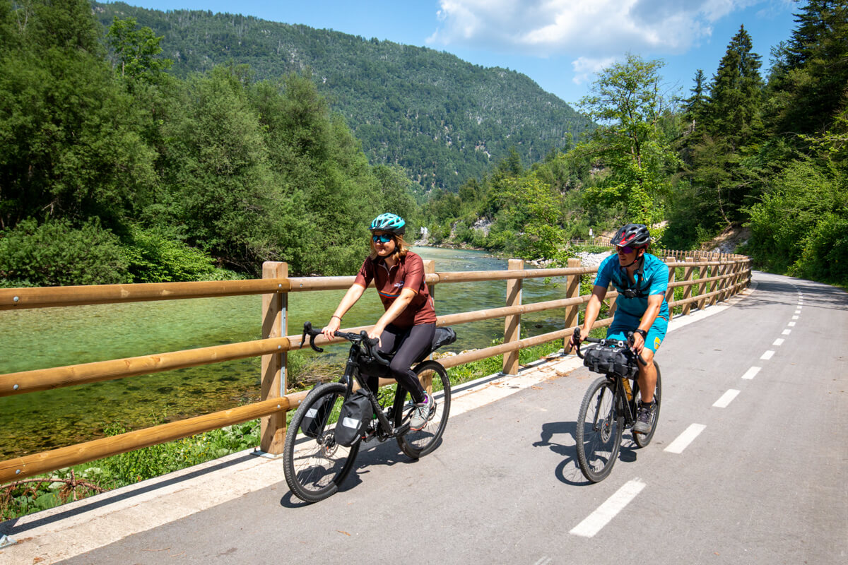
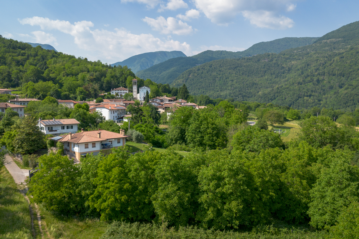
The Trans Dinarica bike route takes full advantage of the country’s varied landscapes and cultural opportunities. The trail starts in Soča Valley, along the Italian border, with the Julian Alps providing the backdrop. The route then follows the beautiful and electric-emerald Soča River into the Goriška Brda wine region before rolling to Slovenia’s UNESCO-recognized Karst Region and then through the foothills of the Dinaric Alps before crossing into Croatia.
Perhaps important information is that the main Trans Dinarica route in Slovenia is probably the easiest of all eight countries on the route, which, together with the well-maintained cycling paths, good public transport and other tourist infrastructure, means that Slovenia is the right choice for anyone who is cycling in our part of the world for the first time. An interesting article with quite a few useful links to attractions in the country can be found on the national tourism website: Trans Dinarica – A Cycling Adventure through the Dinaric Karst.
Highlights along the Trans Dinarica in Slovenia:
- Riding close to the Italian border beneath the Julian Alps.
- Pedaling through the Soča River Valley.
- Drinking wine in the Goriška Brda Region.
- Visiting the UNESCO-inscribed Škocjan Caves.
- Experience the churches and castles around Ilirska Bistrica.
Map of Trans Dinarica in Slovenia
Video about Trans Dinarica in Slovenia
Trans Dinarica Slovenia Gallery


Ready to get navigation/information pack?
Navigation PackMain Route of Trans Dinarica in Slovenia
Stage 1: Tolmin - Nova Gorica
 Distance:
42 km
Distance:
42 km Elevation:
590 m
Elevation:
590 m Paved:
88%
Paved:
88% Unpaved:
12%
Unpaved:
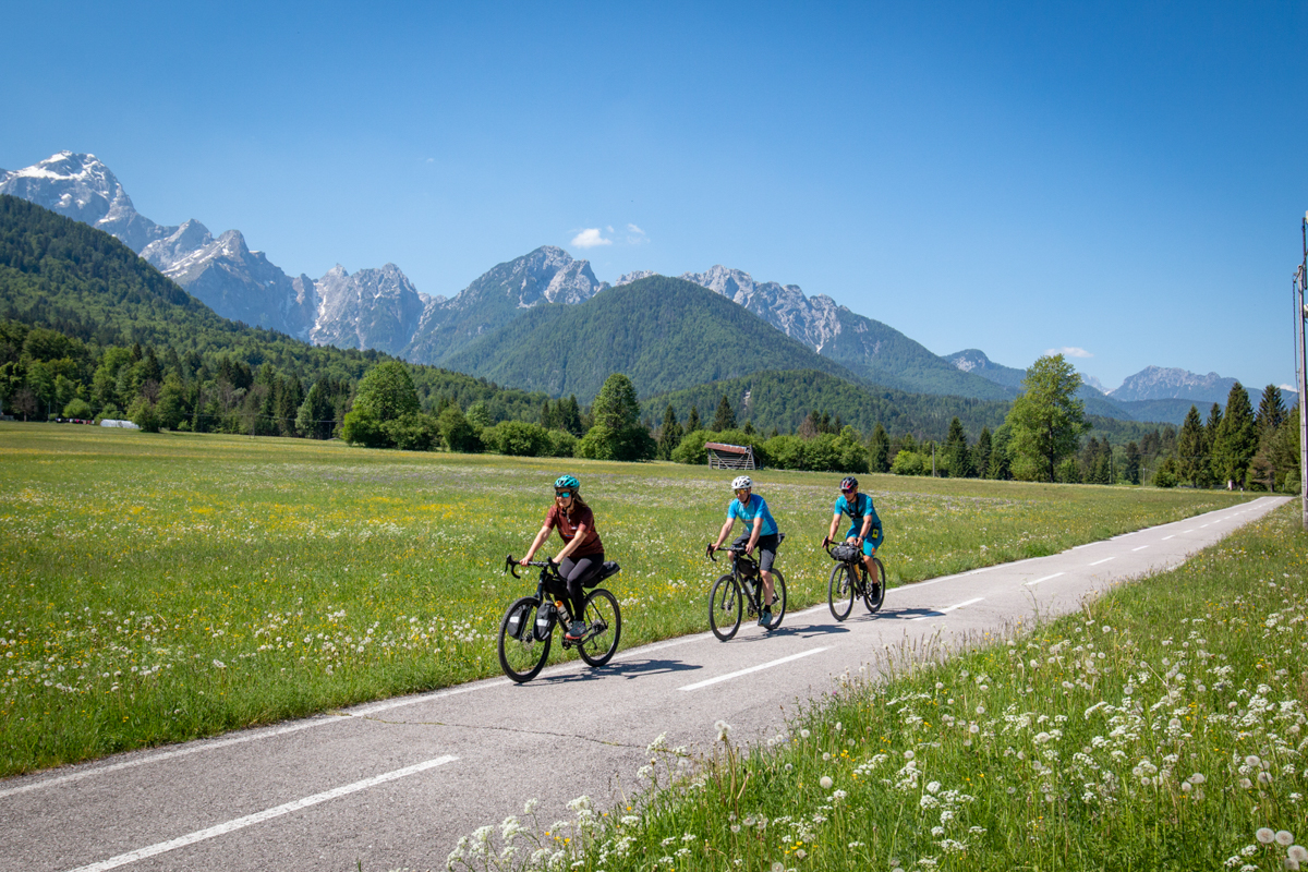
12%The Trans Dinarica cycling route in Slovenia begins in the town of Tolmin, which is tucked in the Alps and wedged between the Soča and the Tolminka Rivers. This town is famous for its music and outdoor festivals and it is the perfect spot to launch this stage near the beginning (or end) of your Trans Dinarica bicycle adventure. While here, visit the Tolmin Museum and don’t miss the Tolmin Gorges.
If you are looking to connect the start of the Trans Dinarica by train, look for the nearby town of Most na Soči, which is well connected to the capital Ljubljana and also internationally (with Italy and Austria). The train is a much better and more comfortable option than the bus, which does not always take bicycles and drives on very winding roads, while the train takes its route through tunnels and valleys along the famous Bohinj railway line. There are also some nice accommodations in and around Most na Soči, so if you don’t want to cycle the same route twice, you can start your Trans Dinarica adventure without visiting Tolmin.
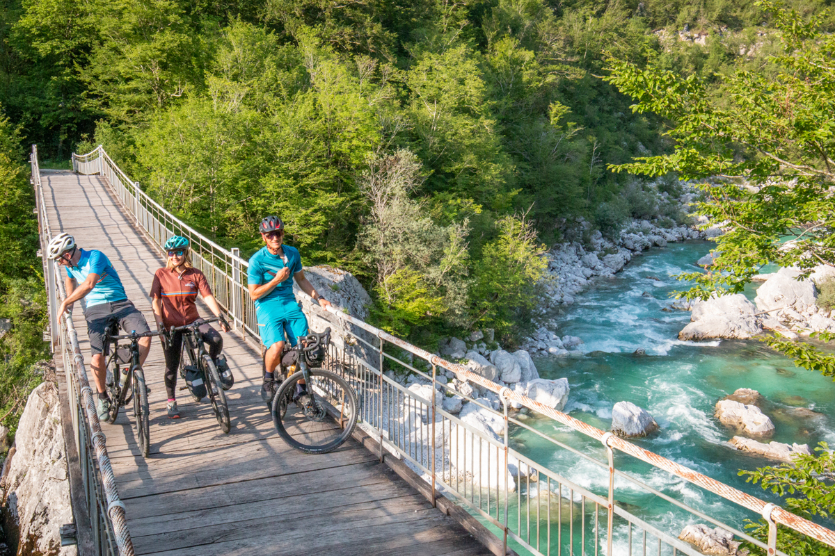
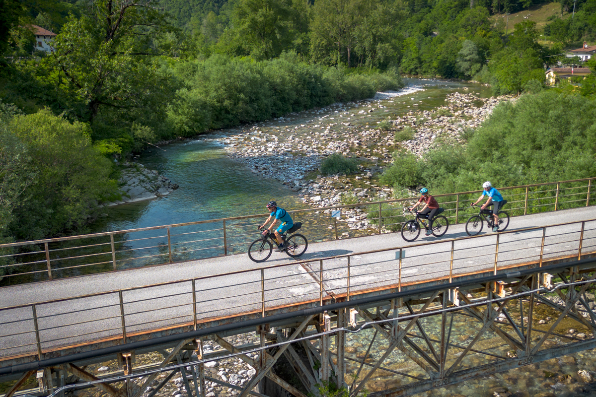
Leaving Tolmin, the route follows a new cycling path along the confluence of the Soča and Tolminka Rivers towards the Most na Soči artificial lake and to the town of Most na Soči (five kilometers along the route). Here, at the confluence of the rivers Soča and Idrijca, is the geographical beginning of the Dinaric Alps (the exact borderline between Dinaric and Julian Alps). For geographers, it is interesting to note that the Trans Dinarica starts almost exactly on the northernmost point of the Dinarides. From here, you’ll have wonderful views of the lake. After a short and steep asphalt climb, cyclists will come to a short challenging gravel section that follows the Soča River high above the left riverbank. This rugged path gives riders a true backcountry cycling experience and the sensation that you’ve entered a remote and wild section of the stage. Let’s say this is the first test if you and your bike are ready for the Trans Dinarica (yes, further south it will be even more difficult).
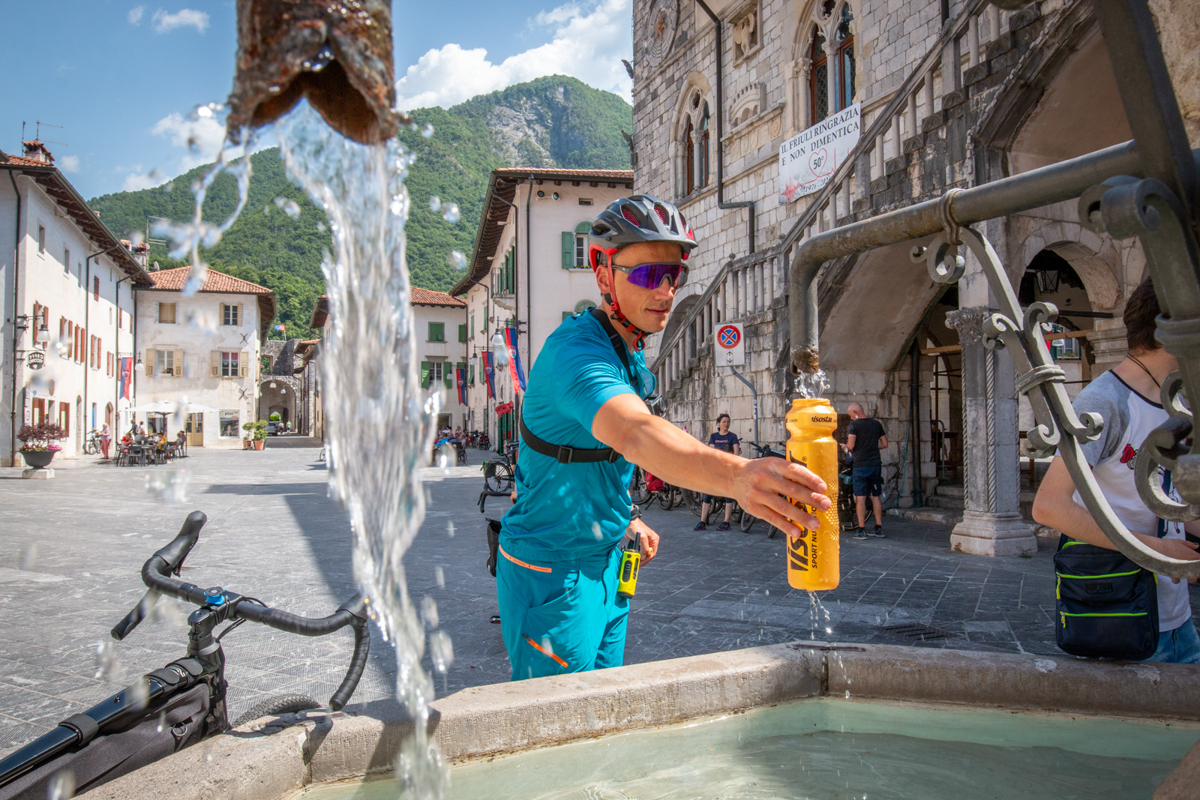
The cycling route becomes easier near the halfway point of the stage, close to the town of Kanal (Kanal ob Soči). You’ll transition onto a quiet asphalt road that crosses the Soča River over an old stone bridge in the village of Kanal itself. At about 28 kilometers, in Plave, cyclists will find a quiet cycle path to Solkan and directly along the Soča River. You’ll ride past the old stone railway bridge and cross the river again over the new bridge just for cyclists and pedestrians. From here, cycle directly along the national border with Italy, to the head of the Vipava Valley until Europa Square in Nova Gorica, which has been named, with its next-door sister city Gorizia in Italy, the European Capital of Culture for 2025.
Alternative suggestion:
Tolmin – Kolovrat – Sabotin – Nova Gorica
- Distance: 59 km
- Elevation: 1.480 m
- Paved: 88%, unpaved: 12%
For those looking for a more challenging option, this alternate stage doesn’t follow the Soča River and roll through its valley. This course climbs high along the Kolovrat Ridge and rides above the Soča Valley, adding scenic views and historical sites to this cycling trip through Slovenia. Choosing this bike path also brings historical places such as the WWI Kolovrat Outdoor Museum into play — as well as providing great views of the mountains and the Soča Valley itself. Cyclists should expect quiet and remote asphalt and partially gravel roads along the ridge with surrounding forests giving needed shade.
This Trans Dinarica alternative will ride past the peak of Mount Korada, where you can find a possible three-kilometer detour for great views of the mountains behind and towards the Goriška Brda region. Just before you dive deep into the famous Goriška Brda vineyards, which carpet the landscape, the route turns left and follows a picturesque and narrow road just below the Sabotin Ridge. Again, this alternate course allows for the possibility of visiting spectacular historical places directly on the ridge, such as the WWI Museum and caverns drilled through the ridge-top to see the other side with a steep drop directly to the Soča Valley.
The stage crosses to Italy, where there is a possibility to take a short bike detour (and short hike) at the end to the top of Mount Sabotin, where you’ll find wonderful views from the ridge that, although narrow and steep, is easy to access. The final section includes a steep descent along the old military road down towards the Soča River, where you’ll cross the green border back into Slovenia, and connect to the main route just before the new suspension bridge.
Suggested accommodation:
Sabotin, Hotel & Restaurant***
The three-star hotel with the Green Key sustainability label is located in Solkan, very close to the main Trans Dinarica route in Slovenia, and only a kilometer away from the Soča River. In addition to 122 beds (from 1- to 4-bed rooms and two apartments with a kitchenette), restaurants with pizzas, Mediterranean, and local specialties offer all cyclists free use of guarded parking for bikes with the possibility of charging your e-bike. More info: website / facebook / instagram
Lipa, Hotel & Bistro***
The three-star hotel with the Green Key sustainability label next to the main square in Šempeter pri Gorici offers 42 air-conditioned rooms of various sizes. The location is great both, for those who are going along the main Trans Dinarica route towards Sežana or if you will ride along the secondary route along the Vipava Valley. In addition to the buffet breakfast, the hotel’s bistro offers dishes like pasta, burgers, steaks and some traditional dishes, such as ‘frtajla’ or ‘šemperski štruklji’, perfect for fueling up after a day of bike touring. A secure bicycle parking is available for cyclists. More info: website / facebook / instagram
Stage 2: Nova Gorica - Sežana
Distance:
53 kmElevation:
800 mPaved:
55%Unpaved:
45%Trans Dinarica’s next stage begins in Nova Gorica, where you’ll find cafes, galleries, and some nice restaurants. Take some time to enjoy a rare instance (anywhere in the world) of cross-border tranquility that Slovenia and Italy have accomplished with their two sister cities. From here the route travels along tranquil cycling paths that lead cyclists safely through the larger urban area and past the towns of Šempeter pri Gorici and Vrtojba. From here, the cycling route will slowly approach the edge of the Karst Region. This is a good place to get your camera ready because of an upcoming and spectacular crossing of the Vipava River — close to the town of Miren — over an improvised bridge atop of a pipeline.
The route will hop on a gravel surface as you climb up to a plateau above the Karst Region — with a suggested detour and stop at the 25-meter-high Monument of Peace and Observation Tower in Cerje. Also, a nice place to take a break, there is a coffee shop and great views of the Soča and Vipava Valleys and the Alps spreading out behind. From here, cyclists will ride across the typical karst landscape — a combination of lush river valleys and barren limestone-filled expanses leading to the sea.
Adventurers will roll through old villages, past historical monuments, caves, and other landmarks all the way to the village of Komen and the nearby village of Štanjel, where you will be squarely in one of the most beautiful areas of the country. The stage will become gentle (fairly flat) rolling hills that go between gravel and asphalt for the next 20 kilometers — through the prehistoric site of Debela Griža — ending with enjoyable gravel cycling along the new karst cycling path, all the way to the town of Sežana.
Tip: if you are surprised by bad weather or some other (technical) problem that day, you can choose the Nova Gorica – Sežana train, which will take you about an hour.


Suggested accomodation:
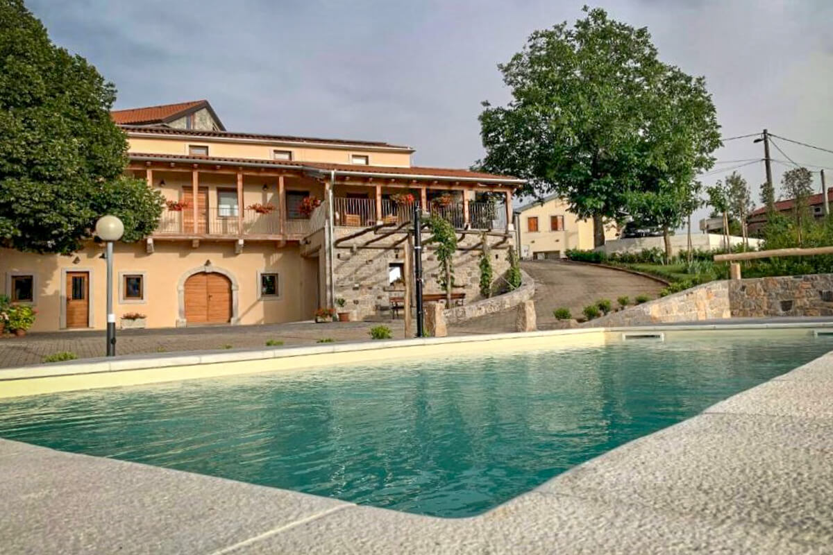
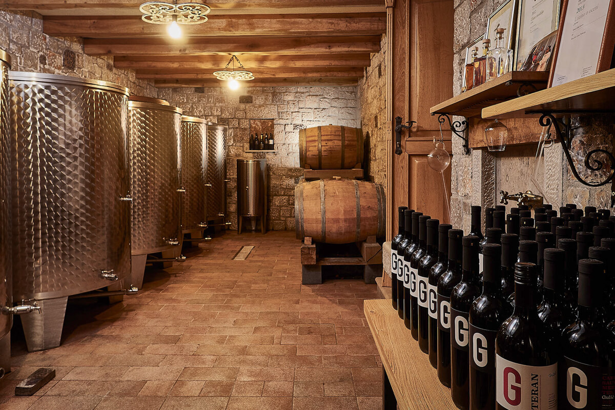
G House, Kopriva
G House is not located directly at the end of the second stage in Slovenia, but if you want to get to know the Karst in the most original way, it is worth stopping in Kopriva, with a shortcut via villages of Krajna vas and Skopo, some 3 kilometers from the main Trans Dinarica route and 11 kilometers from the stage finish in Sežana. The Gulič family are primarily winemakers, known for their superb red Teran wine, rich in iron (if you are anemic, it’s actually a medicine!) and white Malvasia, which produces more intense fruit flavors on the red Karst soil. The old stone house has been stylishly converted into guest rooms; one even has its own jacuzzi and sauna. Cyclists are provided with a secure garage and the possibility of charging e-bikes. Don’t arraive too late so that there is time for refreshing in the pool and try some wine and local prosciutto. Or book two nights in Kopriva and visit the beautiful nearby town on the Štanjel hill on your free day. For Karst, it’s nice to take time. More info: website / facebook / instagram.
Stage 3: Sežana - Ilirska Bistrica
Distance:
54 kmElevation:
890 mPaved:
68%Unpaved:
32%Before starting the next stage of the Trans Dinarica cycle route, take advantage of time in the town of Sežana. Enjoy coffee at one of the cafes and then visit the Sežana Botanical Garden at Villa Mirasasso. From Sežana, you’ll ride directly through the Karst Living Museum, along a quiet gravel road. After, the route shifts onto a wide, single-trail section that takes cyclists on an easygoing section towards the Lipica stud farm.
In Lipica, where you will want to see the famous UNESCO-inscribed (for intangible cultural heritage) Lipizzaner horses and the oldest continuously operating stud farm in Europe at nearly five centuries. From here, you’ll take remote backroads to the peaceful town of Lokev and its Lokev Military Museum (housed in a tower). After more easygoing gravel cycling, you’ll pedal to Matavun and the entrance of the Škocjan Caves, a UNESCO site and one of the country’s calling card points of interest and a must-see on your Slovenia bike tour.
From Matavun, again remote and quiet gravel and asphalt roads take you towards Rodik and the Rodik Mythical Park, where stone and statues create a storytelling venue for the families. Shortly after, at about the 23-kilometer mark, get ready for the steepest gravel climb of the day, which takes cyclists towards the village of Artviže. At the peaceful settlement of Artviže, you’ll start your ride on a long, narrow, picturesque, and quiet asphalt road (for approximately another 28 kilometers) over the Brkini Hills that will take you through beautiful, perched villages to the stage’s final destination of Ilirska Bistrica. If you were unlucky with the weather and were drenched in rain on this stage, take the opportunity to visit the Sušec waterfall in the very center of Ilirska Bistrica, which is a real little miracle after heavy rainfall.


Suggested accomodation:
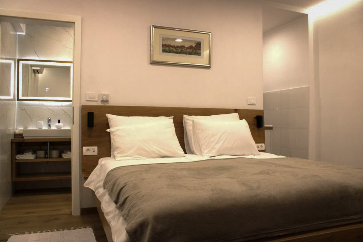
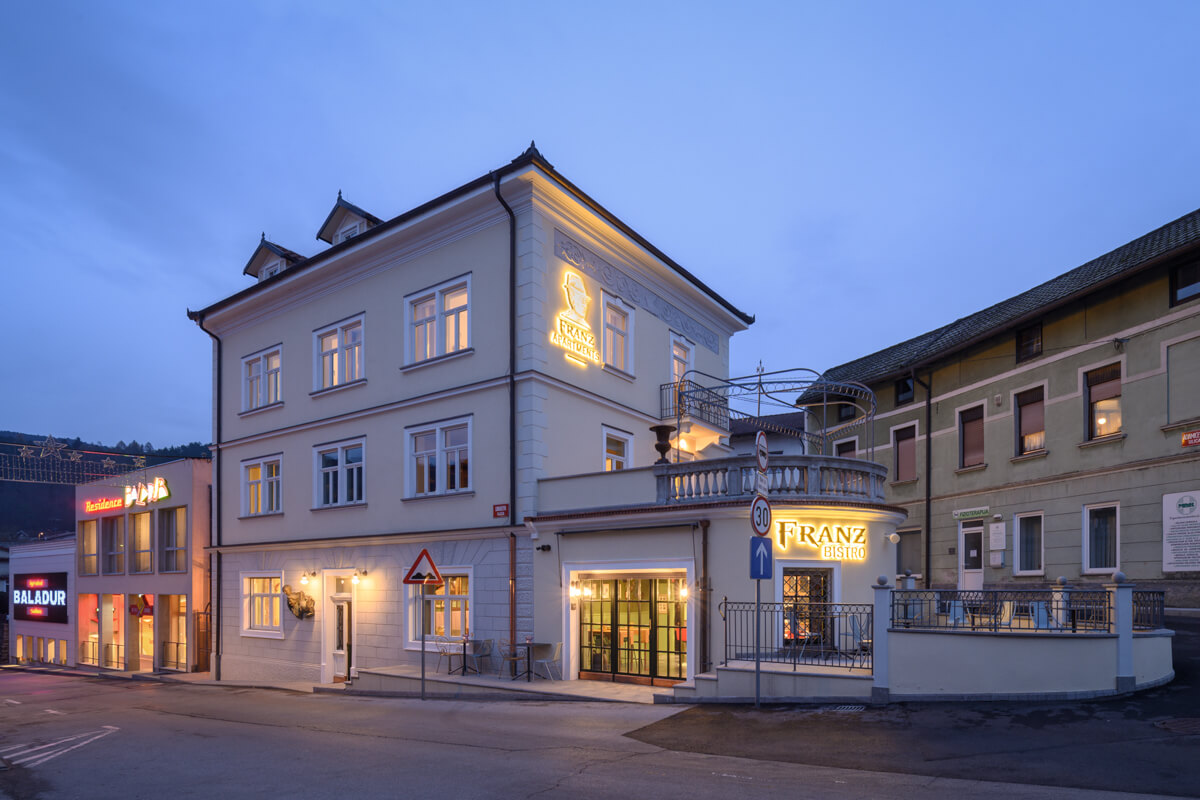
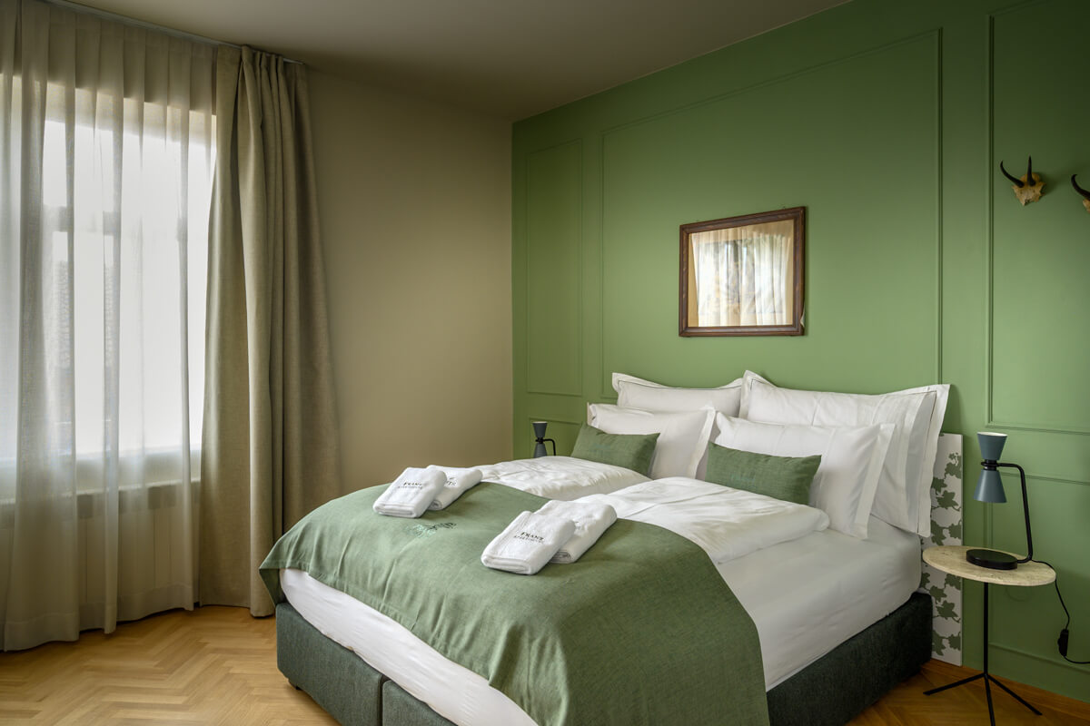
Franz Apartments, Ilirska Bistrica
Franz Apartments is a great cycling base in the center of Ilirska Bistrica, within walking distance of shops, attractions like Sušec waterfall and a pump track (you probably won’t use this, though). It’s also important that cyclists are offered a safe bike garage, e-bike charging, even a bike service (by prior arrangement), access to a washing machine, a sauna to relax your muscles after a full day of pedaling or a fitness center to strengthen them before the tough stages ahead. They offer seven modernly equipped apartments with kitchens (as mentioned, there’s a shop right next door!), a rich breakfast and evening relaxation in the game room with 24/7 access. If you’re not in too much of a hurry, consider two nights in Ilirska Bistrica and explore activities in the nearby Čičarija, the Deer, Fox or Bear cycling trails, or hike up the nearby Snežnik, a mountain with a beautiful view of a large part of Slovenia and all the way to the Adriatic islands. More info: website / facebook / instagram.

Stage 4: Ilirska Bistrica - Čavle (Croatia)
Distance:
50 kmElevation:
810 mPaved:
95%Unpaved:
5%Croatia’s first stage of the Trans Dinarica bike trail actually begins in Slovenia in Ilirska Bistrica. Though centuries old, the town owes much of its character to its important position during the Austrian Empire. Make sure to visit some of the churches and castles in the immediate vicinity — especially the Prem Castle, which was first mentioned in the early 13th century. After, enjoy a meal and a drink in the town center cradled in the Reka River valley.
From Ilirska Bistrica, follow the foothills of the Dinaric Alps Range towards the Slovenia-Croatia border. Just prior to the line, there will be a climb before the village of Novokračine. In Croatia, the route will pass through the villages of Lipa and Škalnica. Risnjak National Park is located about 50 kilometers to the east. Due south, riders will be pedaling over rolling terrain toward the Adriatic.
The last half of the stage is mostly downhill. At the village of Saršoni, the bike route turns left towards (and crosses) the Rječina River before turning south again, where it will follow the meandering waterway. After a steep, but short, climb to the village of Grobnik, the route heads down again. The last three kilometers is an easygoing descent into the destination for the day: Čavle. In Čavle, they pride themselves on their simple but delicious gastronomy: in early summer you might come across the Festival of Polenta and Cheese, while in January (we know, it’s not exactly cycling season) you can enjoy The Kobasica Open – sausage festival.


Alternative suggestion:
Martinovo Selo to Podrvanj (avoiding Grobnik)
- Distance: 6 km
- Elevation: 70 m
- Paved: 75%, unpaved: 25%
To avoid the steep climb to Grobnik, this six-kilometer alternative heads east at the villages of Martinovo Selo and Lubarska, through the village of Jelenje, and takes cyclists to the town of Dražice. Here they will roll south until meeting back up with the main route near the village of Podrvanj and then directly to Čavle—a route perfect for those keen on cycling Croatia while discovering the region’s scenic diversity and accessible trails.
Secondary routes of Trans Dinarica in Slovenia
Stage 5: Tolmin - Sinji Vrh
Distance:
45 kmElevation:
1.430 mPaved:
94%Unpaved:
6%This ‘northern alternative’ cycling route along the Trans Dinarica begins in the town of Tolmin. The first part of the stage to Most na Soči is the same as on the main route. After crossing the Idrijca River (at the six-kilometer mark) and rolling over a brief unpaved section, the route turns left and follows the Idrijca Valley, past the train station close to Most na Soči. From here, the course starts to climb along easygoing asphalt roads towards Čepovan (Čepovanski dol), one of the most beautiful and preserved dry valleys in Slovenia.
From Čepovan, the climb continues towards the small village of Lokve (at around 25 kilometers). The route then takes cyclists deep into the vast forests of the Trnovska Plateau. This remote and well-maintained forest road ascends to the highest point (around 1.200 meters) along the border between the Nova Gorica and Ajdovščina (an ancient town lodged in the Vipava Valley) municipalities. From here, the bike trail begins its descent towards the village of Predmeja.
At Predmeja, the route stays left and up to the ridge of the Trnovska Plateau, which takes you directly parallel and above the Vipava Valley. The Slovenian cycling route passes the small village of Otlica with its famous Otliško okno (Otlica window), a natural stone phenomenon that provides stunning views into the valley. Though it necessitates a short bike-and-hike detour, take the time to get here. It is worth it. At the village of Kovk, the route takes a right turn and a short climb to the end of the stage at Sinji vrh Pension. From here, you will have expansive views over the Vipava Valley and will be ready for a celebratory meal and drink with your cycling companions.
It may be worth mentioning that this alternative route is not best choice for late autumn or early spring. We recommend checking the weather forecast carefully, as snow can surprise you in this part of Slovenia even in April.


Stage 6: Sinji Vrh - Postojna
Distance:
48 kmElevation:
750 mPaved:
66%Unpaved:
34%Another incredibly picturesque Trans Dinarica stage, this one leaves from the Pension and Restaurant Sinji Vrh above the Vipava Valley at an elevation of over 1.000 meters and then steadily descends and follows the edge of the Trnovska Plateau towards the pleasant village of Col at about the nine-kilometer mark. From there, it’s a short climb into the dense forests, which are refreshing on warmer days. Coming out, cyclists should get their cameras ready to catch more spectacular views of the Vipava Valley before starting to descend towards the village of Podkraj.
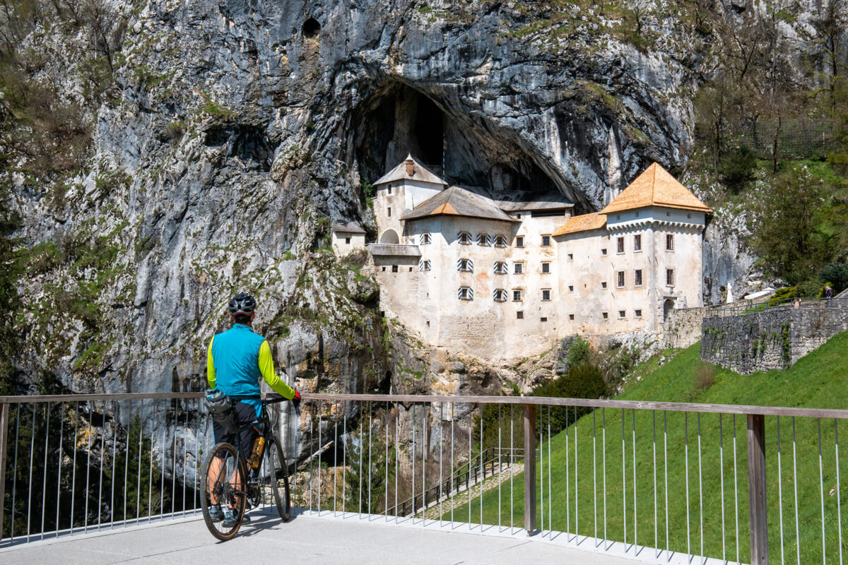
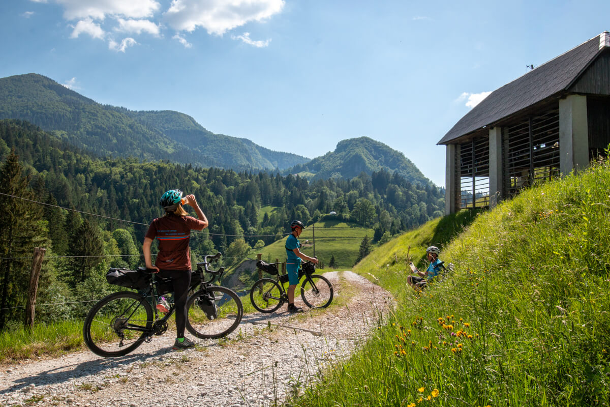
Backcountry cycling enthusiasts will find this stage offers a combination of rolling hills and descents, with much of the surface on unpaved surfaces. The course becomes particularly remote and thoroughly peaceful. For those who love to get away and feel freedom on a bicycle, this is the spot. You’ll experience mostly quiet gravel forest roads that encircle the Nanos Plateau, well known for its hiking trails. From here the route will gradually descend towards the famous Predjama Castle. Built into a stone cave and along a cliff wall, this must-see attraction is more than eight centuries old.
After Predjama, cyclists will find pristine riding along the flat landscape of the Nanoščica and Pivka Rivers that follow. The Pivka River in responsible for creating the world-famous Postojna Caves, and is another must-see on this Slovenia bike tour. The two rivers will converge outside the town of Postojna. This stage — which is packed with classic Slovenian points of interest — will end just above the cave complex and will descend directly to the center of Postojna (around two kilometers from the entrance to the Postojna Cave).


Stage 7: Postojna - Ilirska Bistrica
Distance:
50 kmElevation:
770 mPaved:
48%Unpaved:
52%Cycling Slovenia’s part of Trans Dinarica from Postojna, this stage starts with easy and almost flat cycling towards the Pivka River. Cyclists will pass many opportunities for beautiful, and short, detours to visit the 17 seasonal lakes that are strung across the beautiful Pivka Valley. Adventurers will be pleasantly surprised by the region’s layered heritage and the places where travelers can learn more, such as the Ecomuseum of the Seasonal Lakes of Pivka. You can also visit the Park of Military History.
After the town of Pivka, a new bike path leads to the village of Zagorje, where the route turns left, away from the main road and towards the wonderfully adventurous last part of the stage. This adventure should start with a visit to the remains of the old Kalc Castle. Then, from the village of Bač, the route goes wild (don’t worry, we mean remote) with a gradually climbing gravel road that takes you through pastures and into the forests on the edge of the Mount Snežnik plateau.
Cyclists will slowly climb towards the top of a high grassy plain leading to the top of Volovja Reber with its highest peak, Velika Milanja. (From here, one can do a short bike-and-hike detour to the top). Weather permitting, you’ll have views that open all the way back to Nanos, the Pivka Valley, the Karst Region, the Adriatic Sea, Učka Mountain in Croatia, and the Kvarner Islands. From Velika Milanja, there’s a very challenging, but beautiful gravel descent. If you have narrow tires and/or a loaded bike and/or you are tired, this part may not be the best for the end of the day (see alternative suggestion). It will take you past Črne Njive (Black Fields) directly to the town of Ilirska Bistrica, where you will finish this section of Trans Dinarica’s bike route in Slovenia.


Alternative suggestion:
Zagorje – Šilentabor – Črne njive
Distance: 17 km
Elevation gain: 400 m
Paved: 23%, unpaved: 77%
For those looking for a slightly less demanding alternative, when you leave from the village of Zagorje, this alternate route turns in the opposite direction towards the village of Šilentabor. It is worth taking a short hike to the edge of the small cliff, where there are beautiful views towards the west where the land opens wide.
At Šilentabor, the route follows an old ‘Mussolini Road’ with a tunnel of stone leading you towards the village of Podtabor, where the route climbs up to the village of Šembije. It then crosses the main road and continues along a gravel stretch until you have views of Volovja Reber and Velika Milanja open up in a near distance. The route will climb and then, gradually, descend to the main stage at ‘Črne Njive’ (Black fields) before descending sharply towards Ilirska Bistrica, the route’s final destination.
Stage 8: Nova Gorica - Vipava
Distance:
46 kmElevation:
420 mPaved:
43%Unpaved:
57%From Nova Gorica, this route starts the same way as stage no.2 Nova Gorica – Sežana, all the way until the town of Vrtojba, where it turns left and follows pleasant gravel cycling roads through the vineyards and connects with the Educational Trail along the Vipava River at the town of Renče. From here, the route exactly follows the Educational Trail to the center of the town of Vipava. Choose this stage if you want to visit Predjama Castle and Postojna Cave (both in the vicinity of Postojna) via an easier route.


Stage 9: Vipava - Postojna
Distance:
51 kmElevation:
1.030 mPaved:
75%Unpaved:
25%From the center of Vipava — past several of the Vipava River’s sources — the route continues towards the picturesque old villages of Slap, Lože, and Manče, and continues over the open fields towards the village of Podnanos.
Bike travel enthusiasts will find a pleasant, remote, asphalt road after Podnanos, that continues to the valley’s end, where it climbs steeply to the village of Razdrto. After this short, but steep climb, the cycling becomes easier as it rolls over open fields below the Nanos Plateau and glides to Predjama village with its must-see site: the Predjama Castle. The route then connects to the Northern Alternative. After 15 kilometers, the stage ends in the town of Postojna with its world-famous Postojna Cave.


Connector routes
Connector stage 01: Ljubljana - Postojna
Distance:
63Elevation:
883Paved:
70Unpaved:
30For those who will start or end their adventure in Ljubljana or at the nearby international airport, here is the most direct connection to the alternative route in Slovenia via Postojna (with the famous Postojna Cave and Predjama Castle). When you leave the capital, mostly on cycling lanes, the first 25 kilometers will be easy flat cycling along the edge of the Ljubljana Marshes. In Vrhnika, the climb begins on a partly gravel road, which completely avoids the main road and rejoins it in Logatec. After about 45 kilometers, you will cross a beautiful Planinsko polje, which can become a lake after heavy rains. From the village of Planina, you will push the pedals on a gravel climb (here you can take a short detour to see the natural attraction of Rakov Škocjan), and the last part of this connector stage you will cycle parallel to the national highway and will be happy not to be stuck in steel cages in times of summer traffic jams. In Postojna, don’t miss visiting the caves and castle, and then join the TD-SLO-07 route from Postojna south towards Ilirska Bistrica (or back towards Sinji Vrh or Vipava, if you want to reach the start of the Trans Dinarica in Tomin).
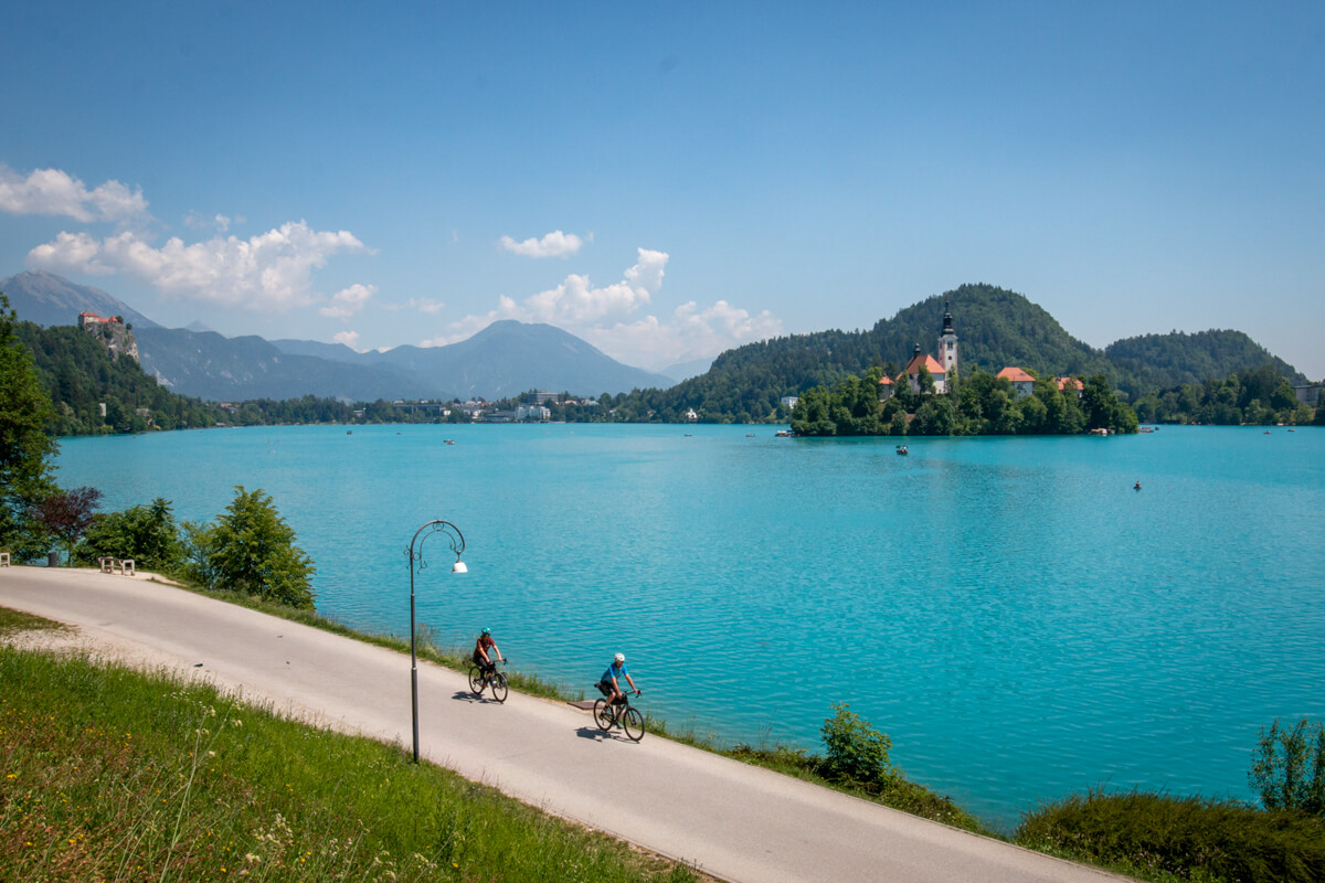
Connector stage 02: Villach (Austria) - Bled lake - Tolmin
Distance:
161Elevation:
2.631Paved:
88Unpaved:
12This connector stage is important for two reasons: firstly, Villach, Austria, is well connected to the international railway network (from Vienna, Salzburg, Zurich and Munich, for example) and is therefore an excellent starting point for cycling travellers from central Europe or for cyclists on the Alpe Adria cycle route. And secondly, this connector stage is not only practical, but also downright beautiful, as it leads through areas with good tourist and cycling infrastructure, such as the ski resort of Kranjska Gora and Bled and Bohinj Lakes. We recommend that you split Villach – Tolmin stage into two or three stages with stops in some of those towns, which, it is worth saying, can be quite lively and also more expensive during the tourist season (compared to the rest of the Trans Dinarica).
A very large part of this connector stage runs along dedicated cycle paths: the entire part through Austria and Italy and then in Slovenia all the way to Mojstrana and then again from Bled to Bohinjska Bistrica (opening in 2026), which is why it is one of the safer cycling connections. The part between Bohinjska Bistrica and Most na Soči, which can be quite busy during the high tourist season, runs along the narrow local road; we avoided on local gravel roads when possible. An alternative, also avoiding the climb to Soriška planina / Bohinj pass, is a scenic ride on the old Bohinjska Bistrica – Most na Soči railway. Most of the trains that run there are designed for the transport of bicycles (newer blue-and-white trains), while the older trains (green/red) with their steep steps and narrow doors are not very practical for loading bicycles.
Connector stage 03: Villach (Austria) - Vršič Pass - Tolmin
Distance:
138Elevation:
2.325Paved:
80Unpaved:
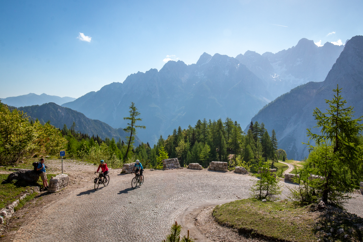
20This connector stage has the same start and finish as the connector stage no. 2 and even follows the same path to Kranjska Gora, Slovenia. There, it leaves the cycle path along the Upper Sava Valley and heads south and uphill to Vršič Pass, 1,611 m, the highest road pass in Slovenia and the Eastern Julian Alps (be aware that the road can still be covered in snow in April!). After admiring the surrounding peaks from the top, a long descent awaits you past the source of the Soča River into the beautiful Trenta Valley and through Bovec and Kobarid to Tolmin, all in the Soča Valley. A length of 138 kilometers may not sound like a lot, but count on almost two thousand meters of ascent, so divide the stage into two daily stages with a stop in Kranjska Gora or Bovec, both famous for outdoor sport activities.
Keep in mind that the Vršič Pass is the only direct road connection between the two Slovenian regions and can be very busy during the high tourist season, in July and August. Since 2023, motorized traffic has been restricted over the Vršič Pass, so this traffic pressure has been reduced, but we still recommend setting off earlier in the day to avoid the company of cars, campers and motorbikes. It is also worth noting that the road is still partly paved by cobblestones, which requires extra caution when cycling and in case of rain.
Connector stage 04: Venice (Italy) - Trieste - Sežana
Distance:
241Elevation:
1.358Paved:
81Unpaved:
19In most cases, the Trans Dinarica cycle route avoids the established tourist destinations, but for many people from the other side of the world, a visit to Venice is a must in their lifetime. Due to the fame that Venice undoubtedly deserves with its uniqueness and history, and due to its fantastic connections to the world by air and land, we have added a somewhat unusually long (but relatively flat) connector stage.
This connector stage is also great for all those who would like to enjoy the Alpe Adria Cycling Route to its finish in Grado, Italy, and then continue towards the Balkans via the Trans Dinarica. The charming seaside town of Grado and its surroundings are worth a visit due to its exceptional location between two rivers that flow into the Adriatic Sea, the Soča and the Tagliamento; the Marano-Grado lagoon in between covers an area of 160 square kilometers and impresses with its wide panoramas and lush wildlife. The connector stage touches on another city worth visiting, Trieste, which is well connected to Western Europe via rail connections and has its own international airport (Trieste Airport). Once you start climbing away from Trieste (and the Adriatic sea) and cross the border with Slovenia, there are only a few more kilometers on gravel roads to Sežana, the destination of the second stage of the main Trans Dinarica route.
You can split the connector stage from Venice two or three times by stopping in small coastal towns such as Caorle or Bibione and in larger Trieste, where you can enjoy a portion of history, architecture and, of course, Italian cuisine and coffee.
Regarding the safety of the connecting stage itself: you will be using a combination of dedicated bike paths, forest gravel roads to busy local roads, so caution and good visibility (a light-colored helmet, reflective elements on the bike or a vest) will not be superfluous. It is also true that traffic in Italy is a bit more lively. You should expect that most of the route through Italy is very flat (which can be boring for a cyclist who likes more dynamic routes). Let this be an easy warm-up before the Trans Dinarica, which will be anything but flat.
Connector stage 05: Venzone (Italy) - Tolmin
Distance:
103Elevation:
817Paved:
85Unpaved:
15For anyone who would like to come from the northeast of Italy right to the start of the Trans Dinarica in Slovenia, here’s a connecting stage from Venzone on the Alpe Adria cycle route, which you can follow all the way from Salzburg, Austria. The 100-kilometer stage Venzone – Tolmin is relatively flat, without any difficult climbs and is therefore easier than the two connector stages via the Bohinj Pass (02) and Vršič Pass (03). However, cycling a hundred kilometers with a loaded bike is not easy, so we recommend splitting it into two stages with a stop in Cividale del Friuli (if you prefer Italian architecture and cuisine) or Kobarid (if you would like to enjoy the beauty of the Soča River Valley and learn about the history of the Isonzo Front).
The first part through Italy and to Kobarid in Slovenia, the stage mostly runs on local roads, which are not very busy most of the time, but you can still expect more traffic in July and August. From Kobarid to Tolmin, we chose a parallel local road on the other side of the Soča River, which is less busy and safer for cyclists.
Connector stage 06: Trieste Airport (Italy) - Nova Gorica
Distance:
32Elevation:
198Paved:
55Unpaved:
45A short and sweet connection to the airport near Trieste (close to town of Ronchi), which is the closest airport to Trans Dinarica in Slovenia. The route avoids most of the busy roads, partly following the Soča River, first on the left, then on the right bank. And since you will be cycling against the flow of the river, expect an easy climb on asphalt and gravel roads along the whole stage. The destination is Nova Gorica in Slovenia, where you connect to the main (across the Karst plateau towards Sežana) or alternative TD route (through the Vipava Valley to Postojna).
Do you support sustainable travel?
Support SustainabilityUseful information about logistics in Slovenia
- Capital: Ljubljana
- Language: Slovenian
- Currency: Euro
- Driving side: right
- Calling code: +386
- Emergency numbers: Ambulance 112, Police: 113
- The biggest towns close to Trans Dinarica: Most na Soči, Nova Gorica, Sežana, Ilirska Bistrica (SLO) or Gorizia, Trieste (IT)
- Airports: Ljubljana, Trieste, Venice, Treviso
- Trains: Slovenian Railways
- Buses: Arriva, Flixbus and Nomago
- Local tourist organizations: Slovenia, Soča Valley, Vipava Valley, Goriška Brda, Postojna, Kras, Ilirska Bistrica
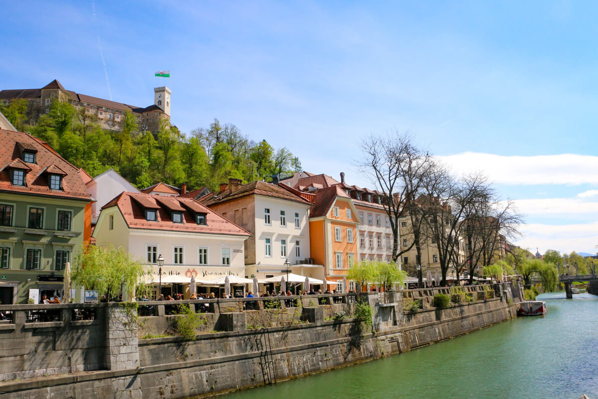
Due to its small size and fantastic geographical location (Slovenia is surrounded by Italy, Austria, Hungary, and Croatia) the first country on the Trans Dinarica cycle route is very easy to reach. Buses connect Ljubljana and the local airport approximately every half hour, the ticket costs some 4 euros. This is much cheaper than a taxi, which costs around 30 euros and up. For current timetables and prices, click here: Ljubljana Airport Bus Timetable. Even if you don’t fly directly to Ljubljana Airport (the airport is only about one hour of pushing the pedals away from the city center), there are large international airports within a radius of a few hundred kilometers: Venice, Milan, Vienna, Zagreb, and Munich. Transfer connections to all of these airports are also good; by train, bus (find links below), or organised transfers like GoOpti. Prevoz.org, a local online platform for sharing transportation is also interesting, while we can’t really say how many people are willing to transport bicycles. When searching for bus connections, you can try Arriva, Flixbus and Nomago.
The train connections within the country and connections with all four neighbouring countries, Italy to the west, Austria to the north, Hungary to the east and Croatia to the south, are also solid – but not always perfect. Slovenian local trains accept bicycles – as long as connections are marked with bicycle icon and there is space on them, so we cannot guarantee that there will always be a free space.
Once you are in Ljubljana, the capital of Slovenia, it is not difficult to get to the starting point of the first stage – Tolmin. By train via Most na Soči and from there 8 km cycling along Soča river to Tolmin. The train, especially if you are car sick, is a much better option than the bus, which takes you along a very winding road. If you would like to cycle from Ljubljana to Tolmin, choose the route Ljubljana – Medvode – Škofja Loka – Železniki – Podbrdo – Most na Soči – Tolmin; there are a few sections of the cycle path to Železniki, otherwise expect a relatively busy road, especially in the July and August.
To improve accessibility to the Trans Dinarica, we have connected the main route with six connector stages:
- from Ljubljana to Postojna, which is on the secondary route,
- from Villach, Austria, to Tolmin, there are two variants (via Bled and Bohinj lakes and over the Vršič Pass),
- and then there are three connections from Italy: from Venzone to Tolmin, from Trieste Airport to Nova Gorica, and from Venice and Trieste to Sežana.
More detailed information can be found in the descriptions of these so-called ‘connector stages’ (green lines on the map).
Ready to get navigation/information pack?
Navigation PackYou might also like ...


Feeling overwhelmed with travel planning?
Leave this time-consuming and stressful task to professional tour operator companies that we suggest and just enjoy the tour.
Ask a professional